Geography Department Banner.  Click to link to Geography Department Website
-
California State University, Northridge Logo.  Click to link to the C.S.U.N. home page.

Geography 150 : Home

Quiz: Post-Semester Assessment

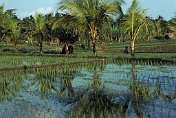
Tropical foilage and rice field

World Regional Geography

The short quiz below is designed to provide you and the instructor for this course a glimpse into the knowledge base you have developed this semester. You may not be graded, but it is mandatory that you complete this assignment. Please answer honestly and to the best of your ability.

Instructions:

Fill in the letter or answer that best answers the questions below.  Use TAB or your mouse to advance your cursor into response boxes. 

Do not press the Enter key until you are ready to submit your answers.  If you do, click the Back button in your browser window. When you are satisfied with your answers, press the Enter key or click on the "Submit" button below.

Make sure you select your instructor's name from the drop down menu and enter your name (first name first and last name last) in the appropriate data entry box below before you submit your answers. 

You are encouraged to keep a dated copy of "answer page" that appears after you have clicked submit in case there is a problem with the submission of this assignment. 


Quiz Table
Question Answer Letter Questions and Answer Options
1.

1.

South Africa has one of the densest clusters of human population. 

a.

True

b.

False
 
2.

2.

Nigeria is the main _______ producing country of Western Africa.

a.

Sorghum.

b.

Rice

c.

Oil

d.

Gold
3.

3.

This river supports a very dense population along its northern reaches

a.

The Nile river

b.

The Amazon River

c.

The Congo River

d.

The Mississippi River
4.

4.

What river is sacred to many Hindus?

a.

Hindis River

b.

Ganges

c.

Brahmaputra

d.

Indus River
5.

5.

What do OPEC nations export?

a.

post consumer goods

b.

open port cargo

c.

optical (fiber) technologies

d.

oil and petroleum products
6.

6

In 1997 Great Britain formally returned possession of Hong Kong to what other country?

a.

Japan

b.

China

c.

Taiwan

d.

South Korea
7.

7.

Portuguese is spoken in the eastern regions of this Latin American country:

a.

Argentina

b.

Brazil

c.

Columbia

d.

Portugal
8.

8

This political group was responsible for killing almost two million people in Cambodia

a.

Khmer Rouge

b.

PRI

c.

Shining Path

d.

Viet Cong
9.

9.

Venezuela is a charter member of this organization:

a.

OPEC

b.

NAFTA

c.

ECOWAS

d.

SAFTA
10.

10.

An unresolved border dispute in South Asia involves:

a.

The Maldives

b.

The Indus River valley

c.

Kashmir.

d.

Nepal and Bhutan
11.

11.

North Korea causes major concern in the international community because:

a.

its refusal to export its oil

b.

massive output of acid rain producing pollutants

c.

its nuclear weapons program

d.

its slave economy
12.

12.

South Africa is characterized by the following:

a.

It still suffers from political system known as apartheid

b.

it is the most fully developed economic power in Africa

c.

it has been witness to many years of civil war in the outer provinces

d.

all of these are true
13.

13.

Shi'ites are the main ethnic group in which of the following countries

a.

Iran

b.

Saudi Arabia

c.

Turkey

d.

Egypt
14.

14.

Where is the climate most often hot and rainy?

a.

In the mid-latitudes

b.

Along the tropics of cancer and capricorn

c.

In coastal regions of the tropics only

d.

Along the equator
15.

15.

Mao Zedong was the leader of which country from 1949 until his death in  1976?

a.

Japan

b.

China

c.

Taiwan

d.

North Korea
16.

16.

In the map below (or click here), what country is identified by the number 16?

a.

China

b.

India

c.

Iraq

d.

Pakistan
World Map
17.

17.

In the map above (or click here), what city is identified by the number 17?

a.

London

b.

Moscow

c.

Cairo

d.

Paris
18.

18.

In the map above (or click here), what country is identified by the number 18?

a.

Vietnam

b.

China

c.

Japan

d.

Indonesia
19.

19.

In the map above (or click here), what country is identified by the number 19?

a.

Egypt

b.

Pakistan

c.

Iraq

d.

Saudi Arabia
20.

20.

In the map above (or click here), what river is identified by the number 20?

a.

Indus

b.

Nile

c.

Ganges

d.

Congo


(pick one from the drop down list).

When you click the button below, you will be directed to a web page that shows your answers. The instructor will get a copy of this email as well, but you may want to keep a copy for your records. If you are curious about the correct answers, please bring your questions to class.


C.S.U.N. Seal About Dr. Graves | Site Map | Contact Dr. Graves | ©2003 Steven M. Graves - Geography Department, California State University - Northridge