
Geography Resources

Greetings!
This section of the website has a links to resources for teachers and students interested in California Geography and especially the geography of Southern California, plus resources for anyone interested in the powerful discipline of geography. Much of what is offered here are useable maps, but there are also links to other websites hosted by other organizations and entities interested in the geography of California.
Static Maps
The static maps may be best for printing for classroom use, but may not display well on your computer screen. The large format graphics may not print correctly from your browser window. Make sure you click on "print preview" before you attempt to print one of these maps. Your printer may have a setting that allows you to shrink graphics to fit the paper. A better method is to right click on the map or graphic and save it to your local drive. From there you can open it in your graphics viewer and print from there. An excellent and free graphics (map, photo) viewer can be downloaded from irfanview.com . If all that is too complicated, click on the links with the word "small" to the right of the link. They are sized to print directly from the browser to 8.5 x 11 paper.
Some maps have features labeled and other maps are without labels so that students may use them as study aids. These maps are free to use for any non-commercial purpose.
Google Earth Maps
Many of these maps at this site are in the process of being made available in Google Earth. Google Earth is a free software that students enjoy to use. Users can manipulate the globe in a variety of manners. They can zoom in and out, change the angle of their observation, rotate the direction they they wish to view the earth, etc. More important, Google Earth allows students to create layers of observations, which permits them to begin to think about spatial relationships between objects and patterns. For example, students should be able to make the connection between the lack of rainfall on the eastern side edges of California and the location of the various California mountain chains. The links below take you to Google Earth resources.
Click on the link below to open a new window with more information about Google Earth, including downloads.
Google Earth Home (opens new window)
** Several student have reported difficulties using Mozilla's Firefox
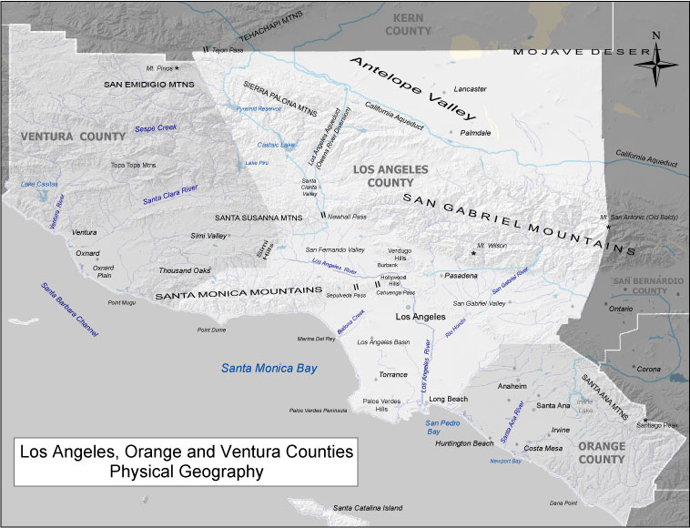
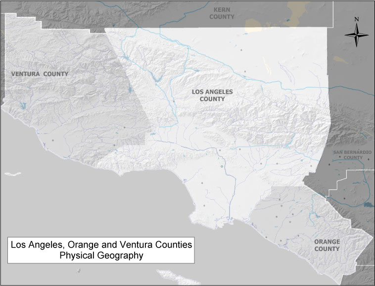
Grade Three - Maps of Southern California
| Map Feature | Google Earth | Static Map (labeled) | Static Map (unlabeled) |
|---|---|---|---|
| Physical Features (grayscale) | Grayscale (.pdf) |
||
| Physical Features (color) | Color (.pdf) |
Color (.pdf) |
|
| Poltical Geography | |||
| Historical Sites Los Angeles County (really cool) |
|||
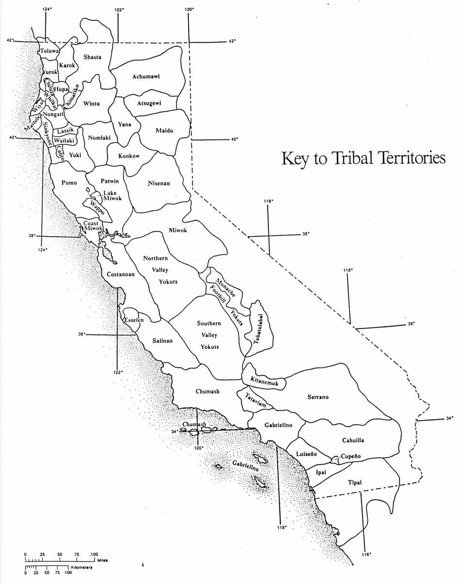
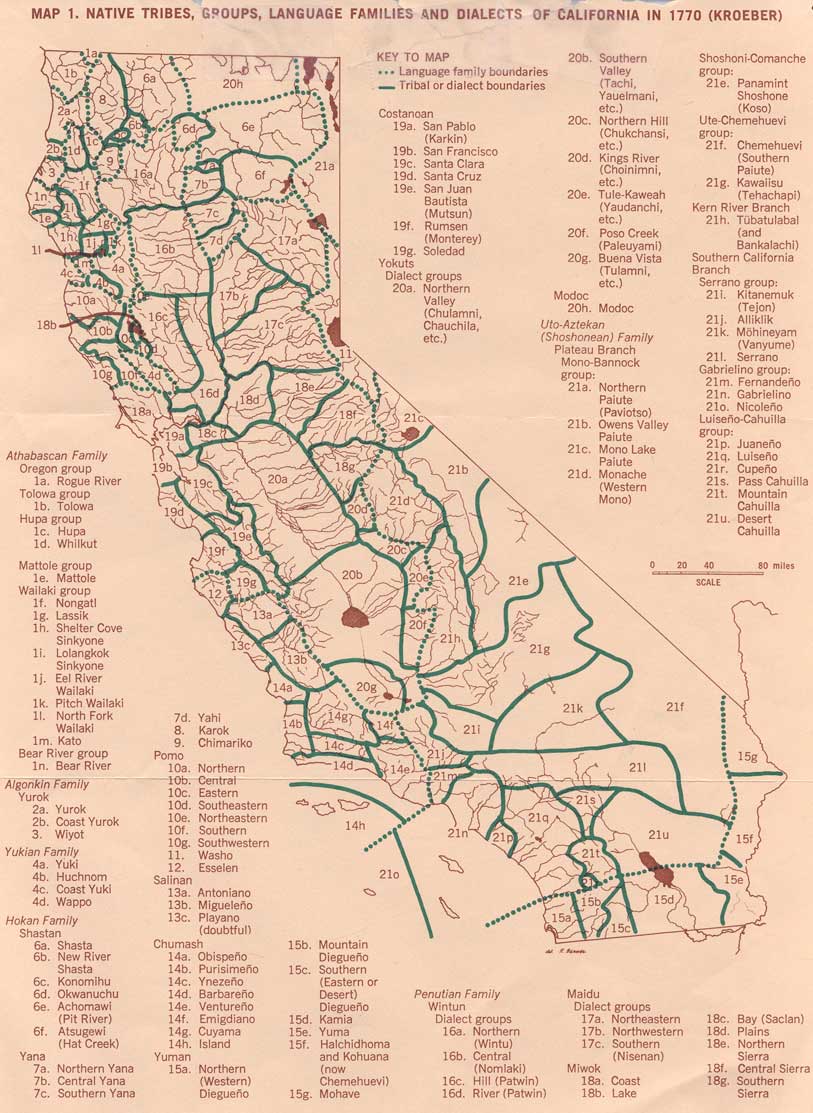
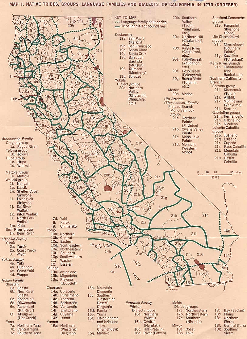
California Indians Language Groups |
|||
| California Indians by Language Groups (overlay map) |
Click to open in Google Earth (very good) |
||
| Los Angeles County Schools | |||
| Orange County Schools | |||
| Ventura County Schools | |||
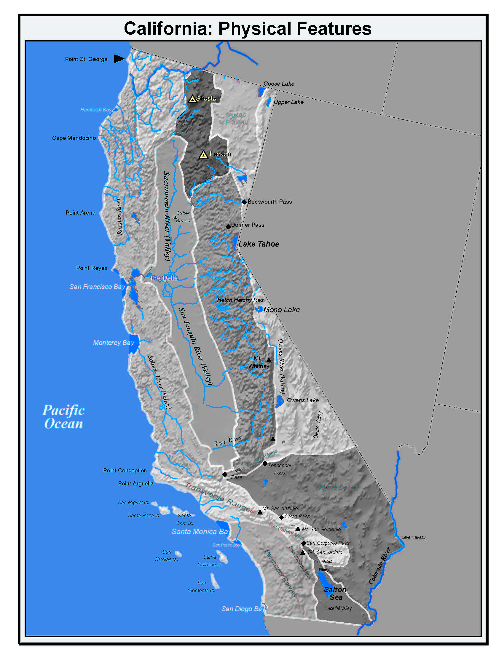
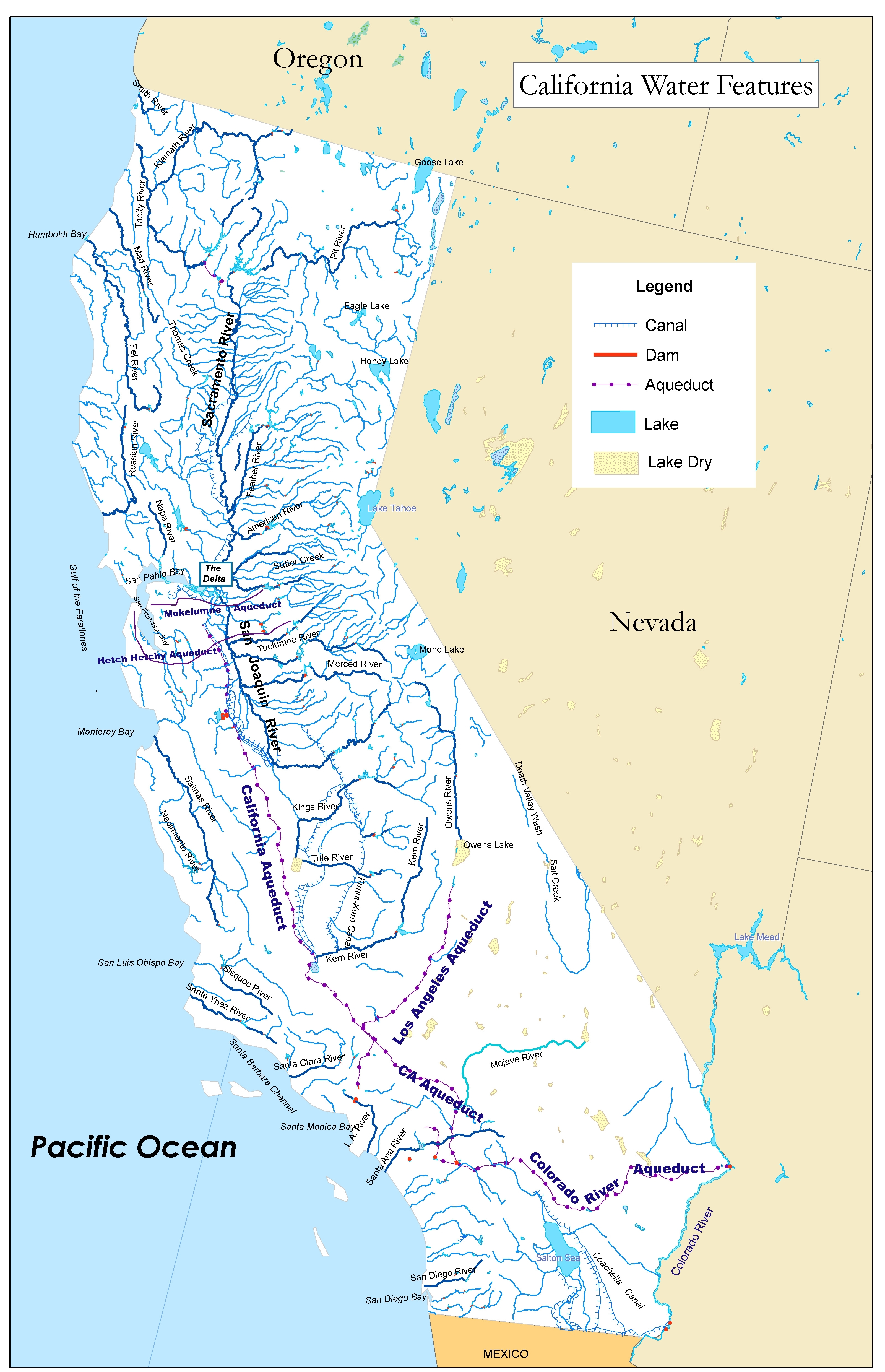
Grade Four - Maps of California
| Map Feature | Google Earth | Static Maps with Labels | Static Maps without Labels |
|---|---|---|---|
| Physical Features Combined | |||
| Major Rivers | Important Rivers (labels pop up) |
Large --- Small | Large --- Small |
| Major Lakes and Bays | Important Lakes and Bays (labels pop up) |
Small | Large |
| Mountains, Points and Passes | |||
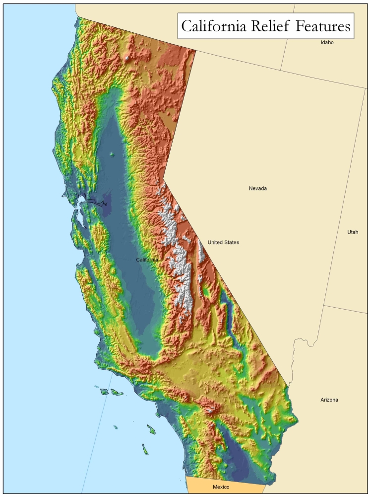
| California Relief Map | Included with Google Earth |
Small | Large |
| Precipitation | Small | Small | |
| Average Temperatures | Small | X | |
| California Climographs | |||
| Mountains, Passes and Points | |||
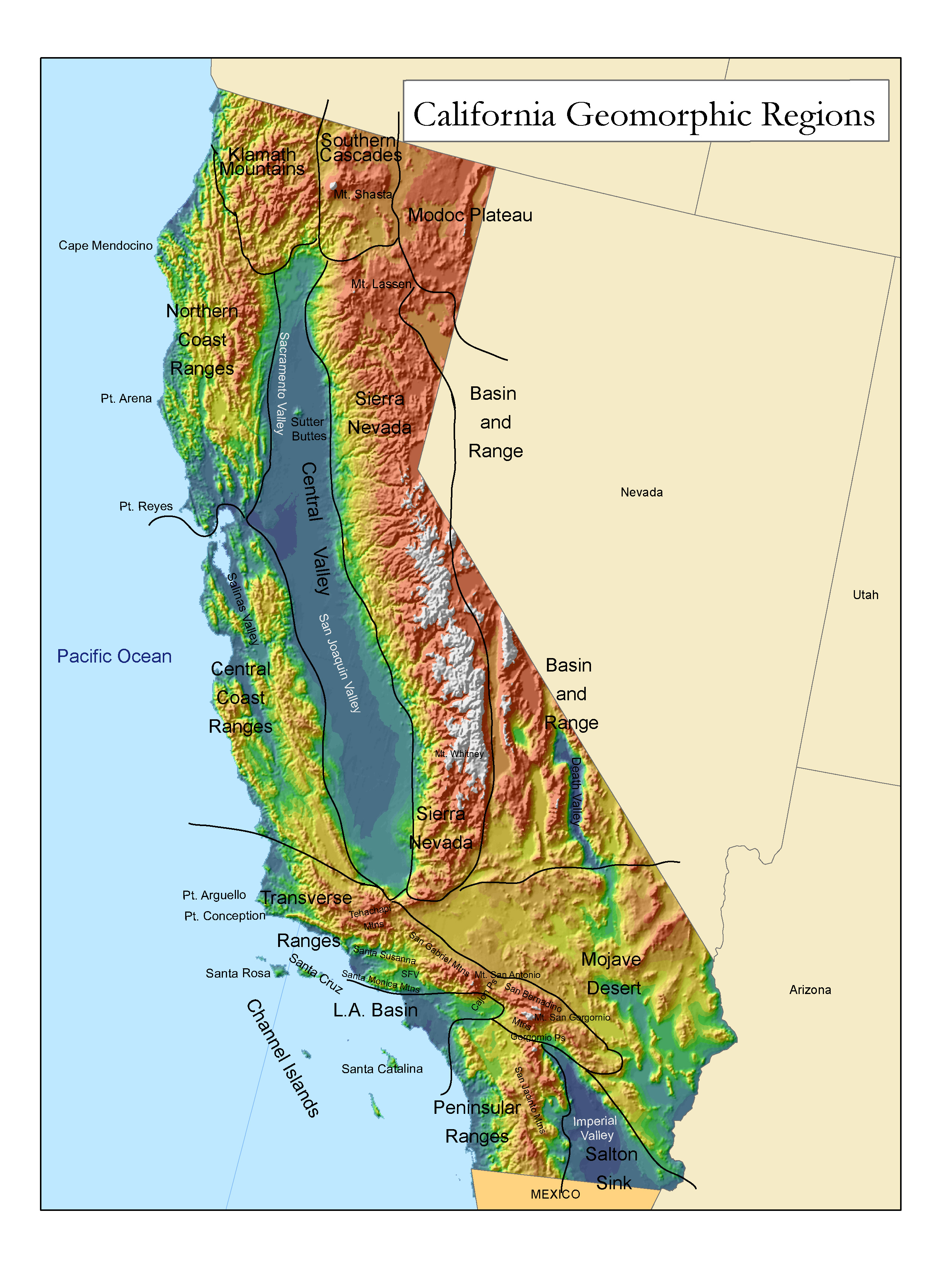
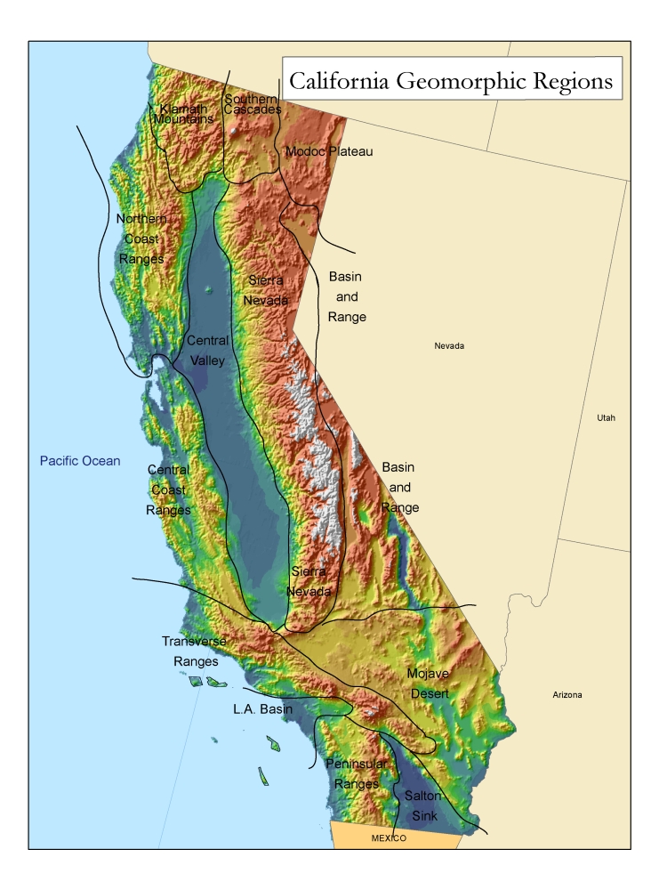
| Geomorphic Regions | Grayscale (.pdf) | Grayscale (.pdf) | |
| Geomorphic Regions | Large --- Small (color) |
||
| Geomorphic Regions (with points, passes and mountains ) |
Large --- Small (color) |
||
| Natural Vegetation | Small | ||
| POLITICAL FEATURES | |||
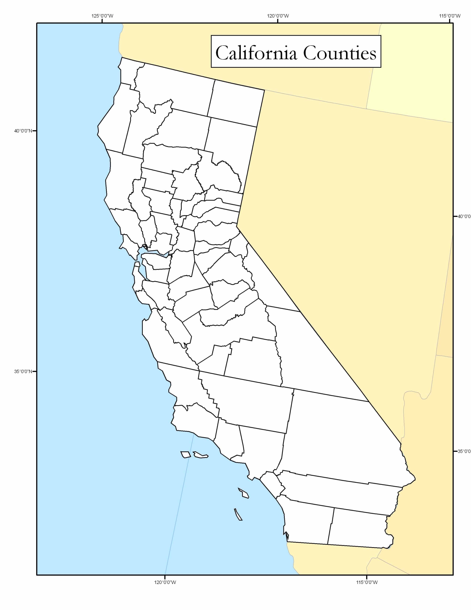
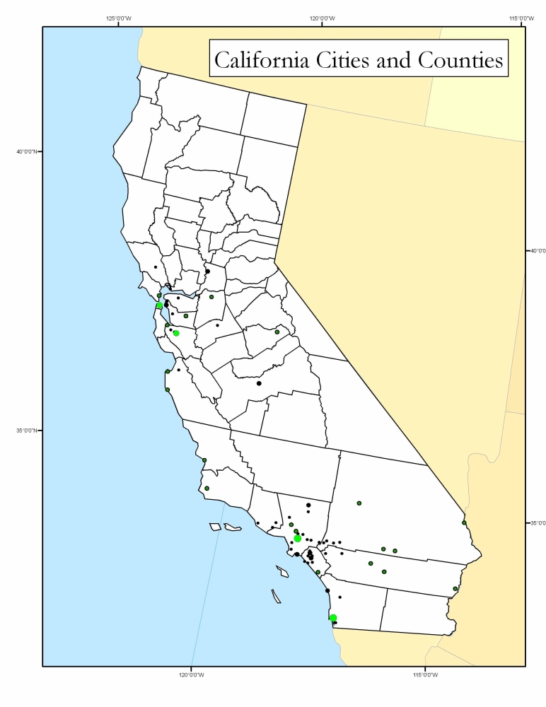
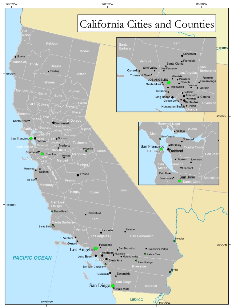
| Counties | California Counties (labeled) |
||
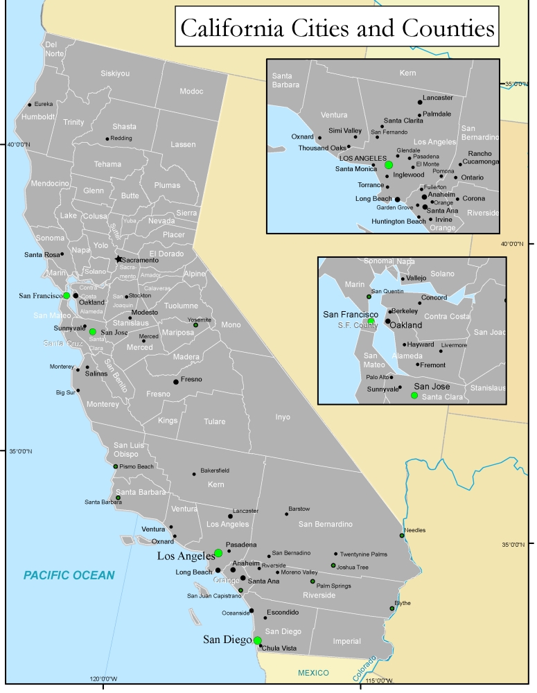
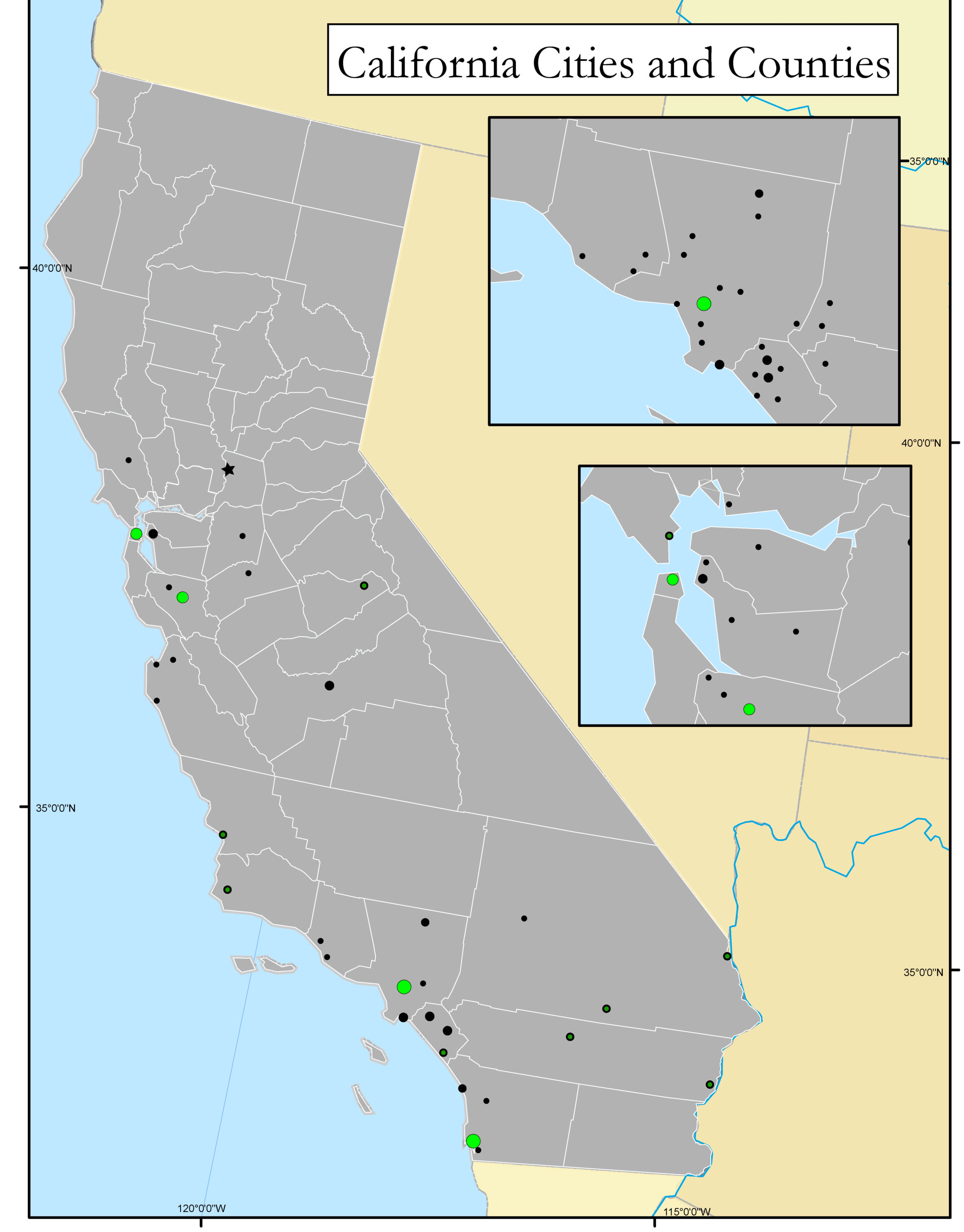
| Significant Cities and Towns | Cities and Towns (pop up labels) |
||
| Significant Cities and Towns | Tabloid Large -- Small |
||
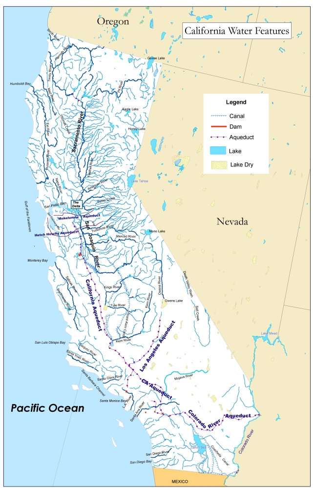
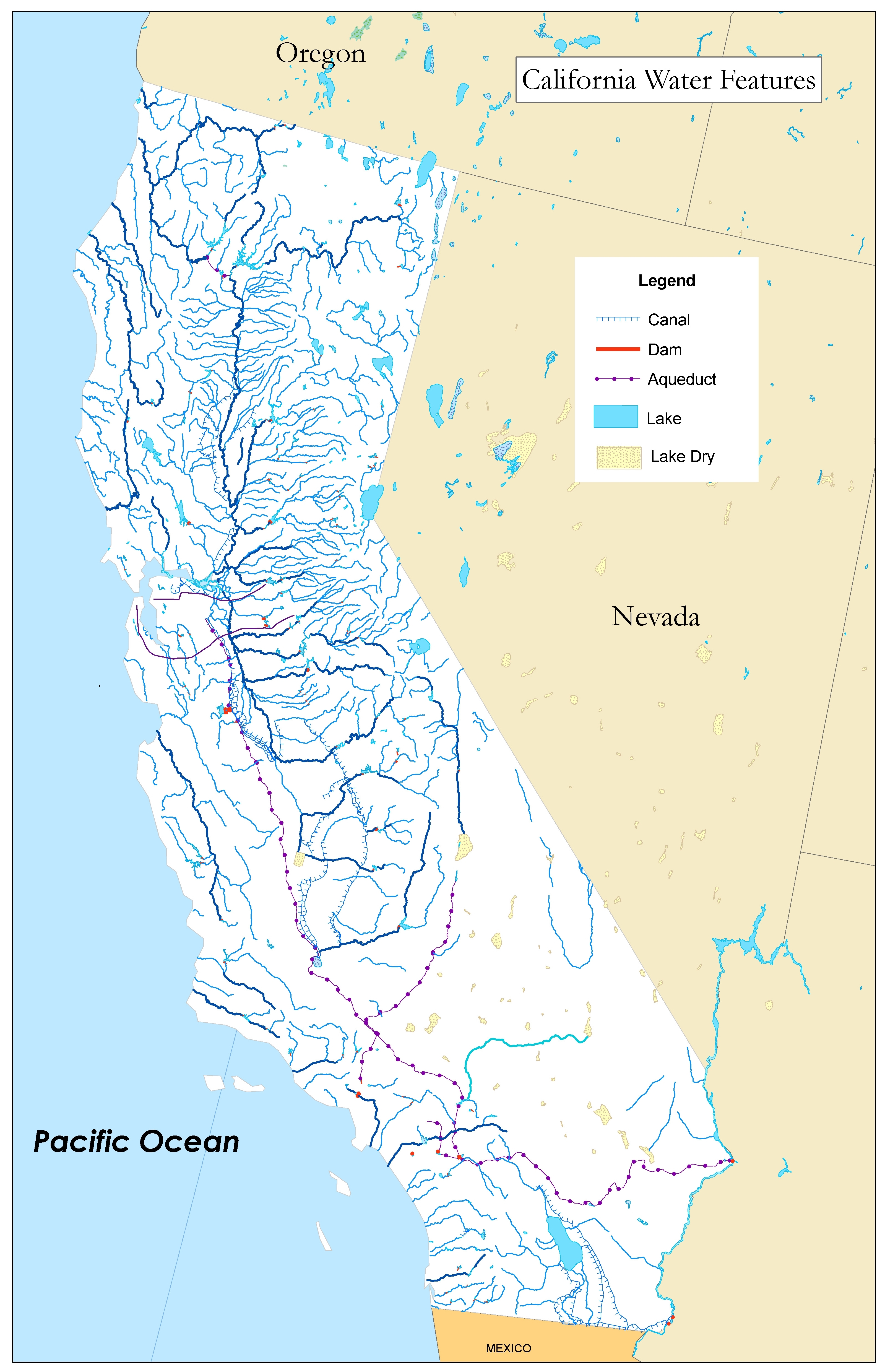
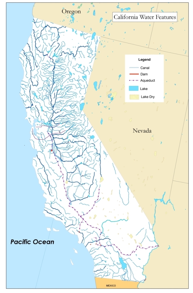
| Aqueducts and Canals | |||
| Land Use | |||
| HISTORY | |||
California Indian Groups |
|||
| California Indian Groups 2 | |||
| California Indians (Language) | Overlay Map (Kroeber's Original-very good) |
||
| California Missions | Missions (outside link -a collaborative effort from the Google Earth Community) |
||
| Early Explorers | USGS Version (pdf -Large) |
||
Additional Resources
- Uncle Buck's World War II Journey (.kml file) Open in Google Earth
Geography Organizations
- California Geographical Alliance (Geographic Education Organization)
- California Geographical Society (Statewide Geographic Organization)
- National Council for Geographic Education (Nationwide Geographic Education Organization)
- National Geographic - Education Foundation (Education Wing of the National Geographic Society)
- Association of Pacific Coast Geographers
- Los Angeles Geographical Society
- Association of American Geographers
- American Geographical Society