Geology of the San Gabriel Mountains
Geology
Earthquakes
- Recent Earthquakes in the San Gabriel Moutnains & Basin
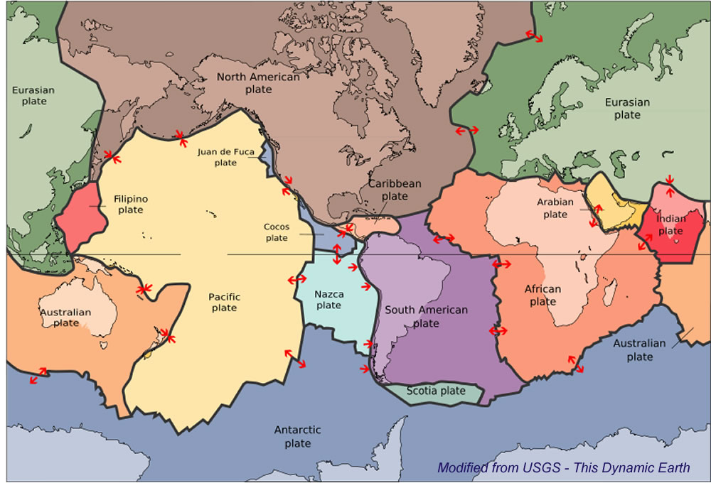
- Plate Tectonics Map
- Seismic hazards
- Faults in the San Gabriel Mountains
Geological Maps
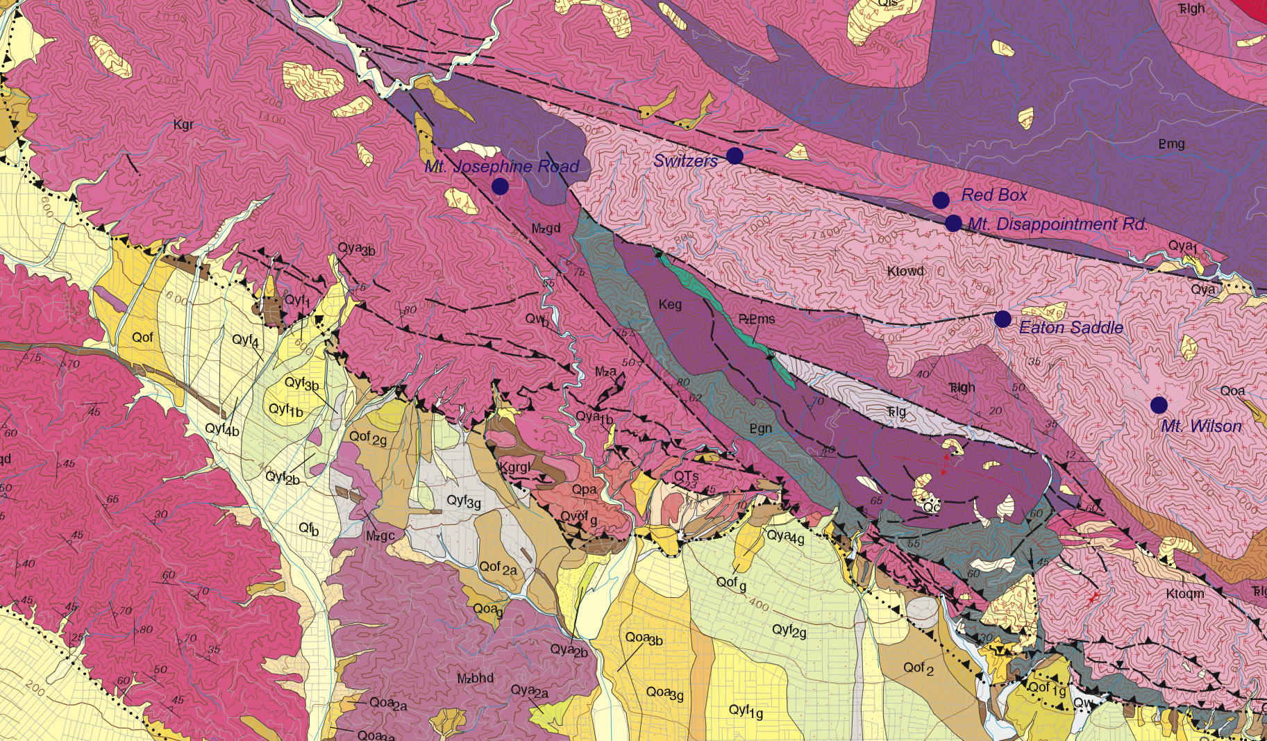
Ktowd Tonalite, (Wilson Diorite of Miller, 1934) (late Cretaceous)—Designated granodiorite and quartz diorite on source maps; identified as mostly tonalite (D. M. Morton, oral communication, 2003) in IUGA classification (Streckheisen, 1973). (northern Mount Wilson 7.5’ quadrangle)
Mzgd Granodiorite (Mesozoic)—Average composition is quartz diorite using IUGA classification (Streckheisen, 1973), quartz 16 percent, plagioclase 62 percent, orthoclase 3 percent, biotite 11 percent, hornblende 6 percent; includes some rocks mapped as Lowe Granodiorite and Wilson Diorite of Miller (1934); mostly massive, but commonly gneissoid near contacts with older rocks; locally carries large inclusions and pendants of gneiss and Placerita metasediments. (San Fernando and Sunland 7.5’ quadrangles; Oakeshott, 1958)
Pmg Mendenhall Gneiss (Proterozoic)—Layered migmatitic felsic gneiss and mafic granulite, having rare interlayered augen gneiss and aluminous gneiss. Gneiss is characterized by large-scale foliation, fracturing, jointing, and blocky shattering. Dikes of anorthosite and associated rocks cut gneiss, and centimeter- to meter-scale fragments of gneiss are scattered through the anorthosite. Most distinctive rock is dark gneiss with tint imparted by blue quartz (Oakeshott, 1958). Named by Oakeshott (1958, p. 21), who designated type locality on Mendenhall Peak. Age of Mendenhall Gneiss is greater than 1,200 Ma age of anorthosite sequence (Silver and others, 1963; Barth and others, 1995)
Qyf Young alluvial-fan deposits, undivided (Holocene and late Pleistocene)—Unconsolidated gravel, sand and silt, bouldery near mountain fronts; deposited chiefly from flooding streams and debris flows; surfaces can show slight to moderate pedogenic soil development.