Geography 103: Weather
Exercise 9. Surface weather charts.
The chart below shows surface data for 12Z on
Print out the data sheet to answer the questions.
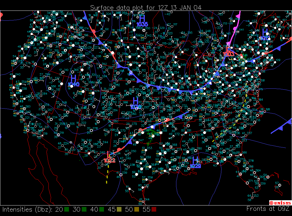
What does the blue line with triangular symbols show?
In what direction is this front moving?
On the chart above, circle the areas where it is cloudy or overcast.
The chart below shows surface data 7 hours later. What has happened to the position of the cold front?
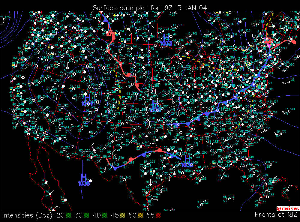
On the chart above, circle the areas where it is cloudy or overcast.
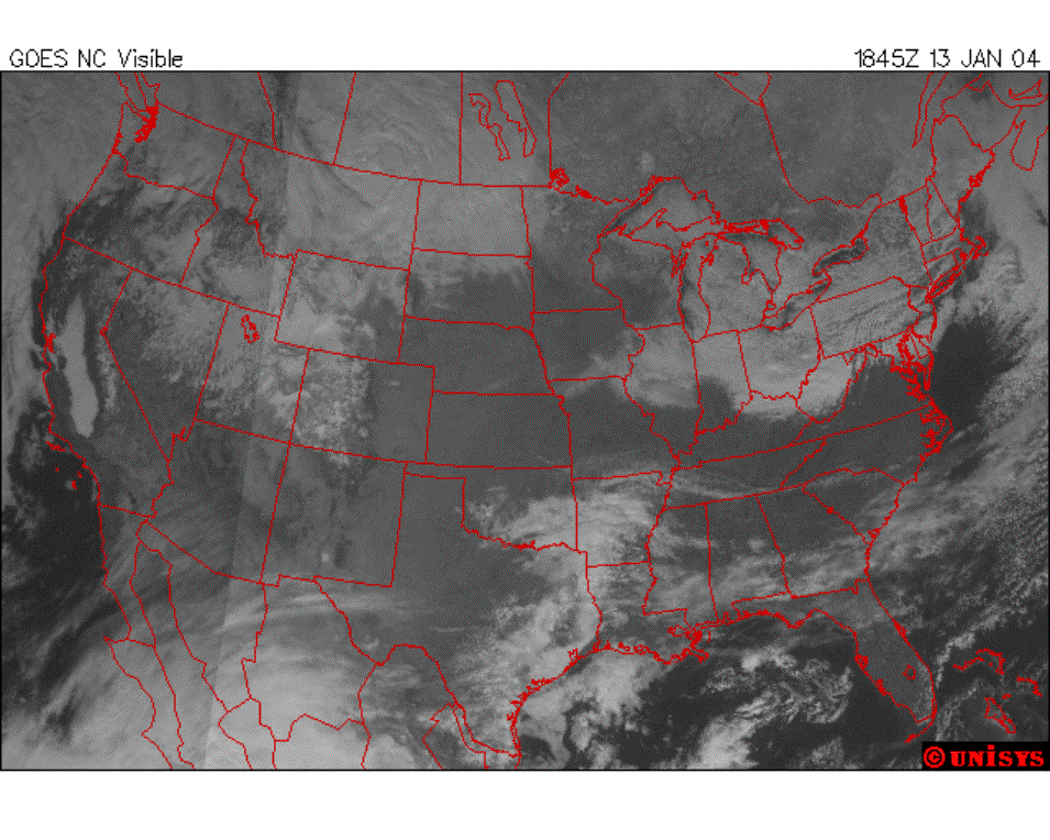
The chart below shows the GOES (weather satellite) image of clouds for the same time. Do the areas of cloud cover below correspond to those you marked above?