Geography 103: Weather
Exercise 10.
The chart below shows surface data for 12Z on
Print out the data sheet to answer the questions.
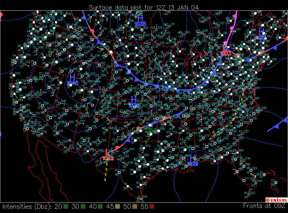
Locate
Locate
Using the chart below (same chart as above but enlarged to
show just the southwestern
What is the temperature in
What is the dew point in
How would you describe the sky in
Using the chart below what is the surface pressure in
What is the temperature in
What is the dew point in
How would you describe the weather in
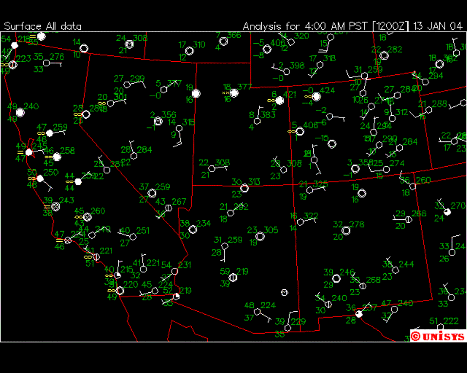
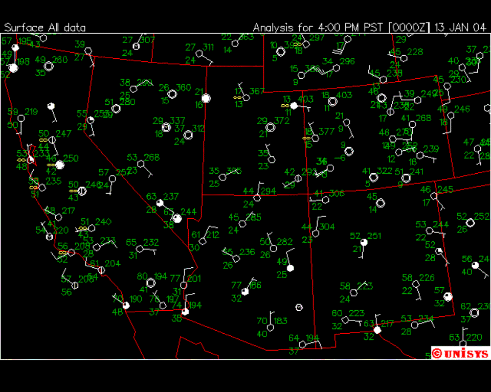
The chart below shows the surface conditions in the southwestern U.S. 4 hours later on this same day.
What has happened to the temperature, pressure and sky
conditions between
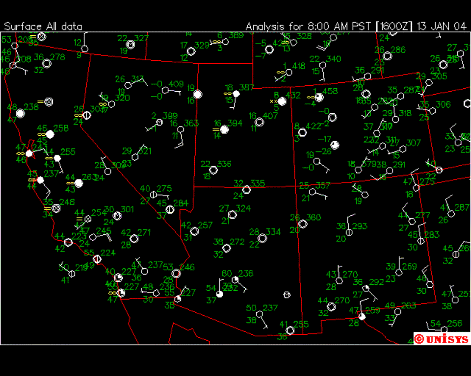
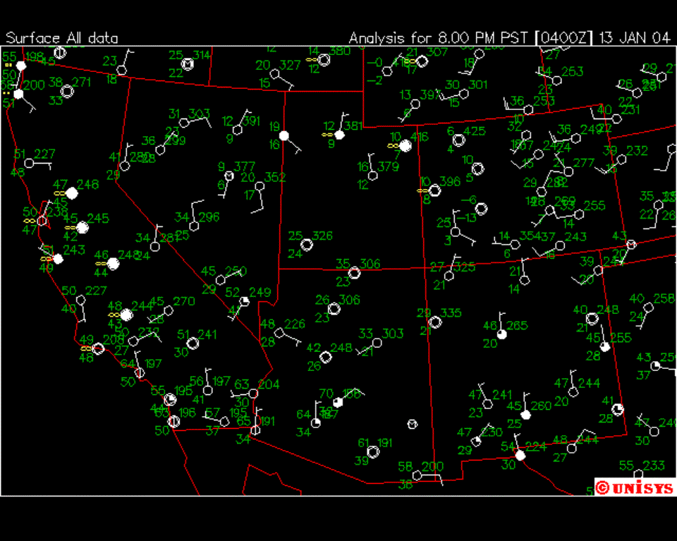
The chart below shows the surface conditions in the southwestern U.S. 4 hours later on this same day.
What has happened to the temperature, pressure and sky
conditions between
The chart below shows the surface conditions in the southwestern U.S. 4 hours later on this same day.
What has happened to the temperature, wind, and pressure between
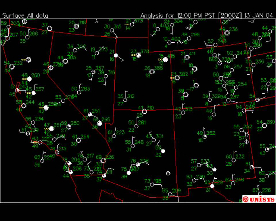
The chart below shows the surface conditions in the southwestern U.S. 4 hours later on this same day.
What has happened to the temperature, wind, and pressure
between