 Tree Inventory and Urban Forestry
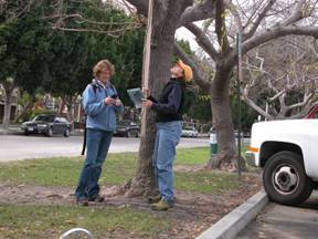
We are involved in a project to map the locations and characteristics of trees as part of the Sun Valley Community Forestry Program. This program, conceived by the Treepeople organization, is aimed at improving the physical environment in the Sun Valley/Burbank area through an extensive tree planting and maintenance effort. We became involved in this community project when approached by Treepeople, who were looking both for guidance in using GIS, and for geography students who might assist with project design and volunteer training. The first phase of this project is the design and execution of a program to inventory the trees. I am working with Anna Huber, a student in the geography department, to formulate the methodology and design the database which will be used in this inventory.
© 2005,
Anna Huber
 Flooding and Hydrologic Modeling
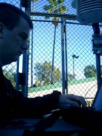
![]() We
are carrying out research on the surface water runoff in Sun Valley. This work is tied to a plan by the Los
Angeles Department of Public Works to mitigate flooding problems in the area by
a multiphase project which is beginning with the installation of an
infiltration basin in
We
are carrying out research on the surface water runoff in Sun Valley. This work is tied to a plan by the Los
Angeles Department of Public Works to mitigate flooding problems in the area by
a multiphase project which is beginning with the installation of an
infiltration basin in