Inversion Layers
In a typical situation, the
atmosphere (with regard to the troposphere) becomes cooler as elevation
increases. An “inversion” occurs when a
section of the atmosphere becomes warmer as the elevation increases. Inversion layers are a significant factor in
the formation of smog in
The first diagram (Fig. 1)
shows what is known as a Marine Inversion.
This occurs when cool, moist air that originates over the ocean is blown
onto land by our prevailing westerly winds.
The cool temperature of this air makes it more dense, so it readily
flows underneath the warmer, drier air that is present over the basin. This type of air flow is also accentuated by
the fact that land surfaces are heated more rapidly during the day than the
ocean. This extra heating creates rising warm air, which then draws in the
cooler ocean air.
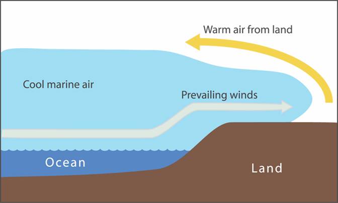 Fig. 1.
The second diagram (Fig. 2) shows
a Regional Subsidence Inversion. This occurs when air flows down from a higher
location to a lower elevation. As air
sinks, or descends, it’s warmed because of the compression it undergoes. Typically, this air is also dry. Not only has it originated over a dry land
mass, but any moisture it may have contained at one time was likely condensed
and precipitated out as it rose over our local mountains prior to its descent
into the basin. Mixing of the air masses
can occur on occasion, but once the warm, dry air (appearing in
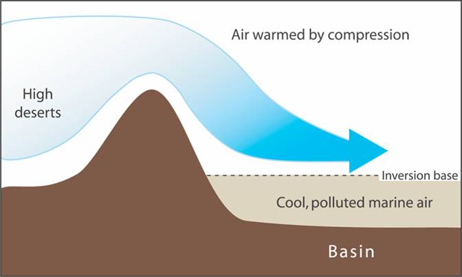 Fig. 2
The third diagram (Fig. 3) shows a High Pressure
Inversion. Because high pressure systems
are a function of descending air, we again see a situation of warm, dry air
sinking to act as a cap over our cooler marine air. This is a regular occurrence for
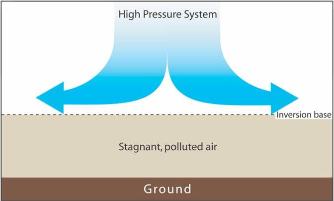 Fig. 3
Written by Anna Huber.
Illustrations from Earth Under Siege, © R. Turco, 2001, © 1997 Oxford University Press
Last updated,