

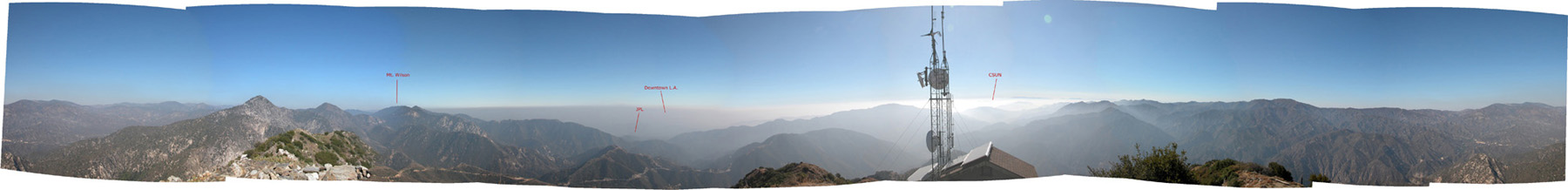
A panorama of the Los Angeles basin documenting an inversion layer
and smog.
Thanks to L.A.’s geography and topography, smog is nearly synonymous
with our city’s name. Given that Los Angeles is located on a low lying coastal plain, surrounded
by high mountains and deserts beyond, air circulation becomes limited by
default. When we add the volumes of auto exhaust from millions of cars (the
estimated population of Los Angeles County is 10,103,000), favorable atmospheric conditions, as
well as plenty of sunshine to the mix, we have excellent conditions for smog
production. Denver, Mexico City, and Santiago, Chile also have significant smog problems because of similar conditions.
The image above was photographed on July 23, 2004 at 5:15
p.m. from the summit of Josephine
Peak in the Angeles
National Forest. Click for a larger
version.
By interpreting a Stuve diagram, such as the
illustration below, we are able to discern weather conditions for a given
location, and understand how inversion layers aid in trapping smog here in the Los Angeles basin.

Written by Anna Huber.
Photograph by Anna Huber, 2004.
Last updated, Aug.
26, 2004.