Geography 103: Weather
Exercise 8. Winds at 300 mb.
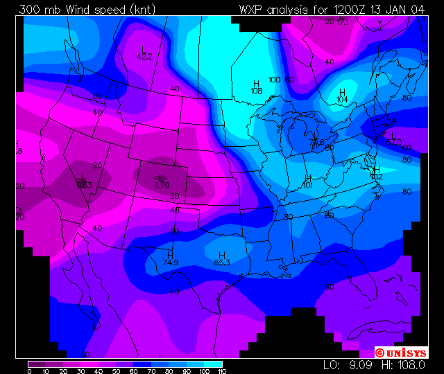
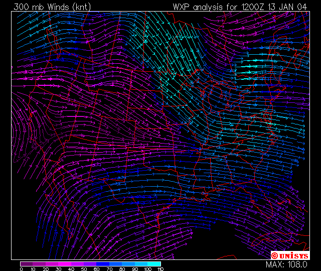
The charts below show the wind speed and direction at the
300 mb level for
Please use the data sheet to answer the questions following.
Approximately what altitude do these charts correspond to?
What units are the wind speeds given in?
What is the separation of adjacent contours in the wind speed (top) chart?
In what part of the
Winds are strongest where there are strong
temperature contrasts in the lower and middle troposphere. Go back and look at the temperature contours
for the 850 mb level. In what part of
the
What direction is the wind in
Do you think this will be bringing colder or warmer air into the region?
There is a strong jet off the northern Pacific coast. How strong are the winds here?
What direction are these winds traveling.