Geography 103: Weather
Exercise 7. An 850 mb temperature chart.
The map below shows the temperature at the 850 mb level for
Please use the data sheet to answer the questions following.
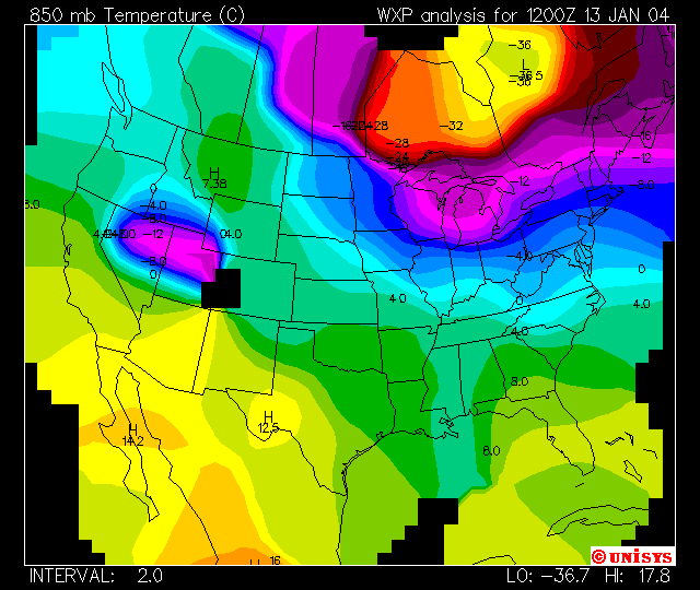
Approximately what altitude does this chart correspond to (in meters/km)?
What units are the temperatures given in?
What is the separation of adjacent contours (in °)?
Where is it warmest at this level - at the top (north) or the bottom (south)?
Mark the location of
Mark the location of
Mark the location of
Look back at your chart of 1000 - 500 mb thicknesses for this date. How are the temperatures at 850 mb related to these thicknesses?
There is a local low temperature in the NE corner of
Does this low correspond to locally large or small thicknesses in the 1000 - 500 mb layer?
There is a local high temperature in the western part of
Does this high correspond to locally large or small thicknesses in the 1000 - 500 mb layer?
Mark the location of
What is the temperature at the border between
Why is